Bayhead Swamp – Wetland forests consisting of wet-tolerant trees, shrubs and herbaceous plants located near the heads of and along the margins of small freshwater streams. These sites drain quickly after rain and are usually part of larger drainage basins. Near the coast, these sites may empty directly into tidal marshes.
Southern Mixed Hardwood– Upland forests with a variety of hardwood and coniferous trees with an understory of small trees and shrubs. These forests are the natural progression of longleaf pine forest in the absence of periodic fire.
Bottomland Hardwoods – Wetland forests consisting of a variety of wet-tolerant hardwood trees, shrubs and herbaceous plants located within the floodplain of moderate to large rivers. These areas are inundated by seasonal flooding to varying extents depending on proximity to the river and elevation.
Longleaf Pine Forest – Upland forests dominated by fire-resistant longleaf pine with an open grassland understory. This habitat is fire-dependent with periodic fires (every three to five years) maintaining the dominance of longleaf pine and the open understory. In the absence of fire, this habitat transitions to southern mixed hardwood forests.
Pine Flat Woods – Pine-dominated forests in moderately to poorly drained flat areas. This habitat typically occurs on sites that supported wet pine savannahs that were maintained by periodic fires.
Wet Pine Savannah – A wetland prairie or open grassland with scattered pines (mostly longleaf pine) located on moderately to poorly drained flat areas near the coast. This habitat is fire-dependent with periodic fires (every three to five years) maintaining the dominance of scattered and fire-resistant longleaf pine and a rich diversity of fire-dependent grass and herbaceous plants. In the absence of fire, this habitat transitions to pine flatwoods.
Swamp – A general term defining a tree-dominated freshwater wetland that is seasonally flooded for long periods of time. Swamps can be further defined by the dominant tree species found there, as in cypress swamp.
Bayou – A slow or sluggish moving stream, creek or small river that flows through marshes and swamps into a larger body of water. Near coastal areas, these areas are exposed to the ebb and flow of tides.
Maritime Forest – A coastal wooded habitat usually found on barrier islands or within a few hundred feet of a mainland shoreline. These areas are exposed to salt spray and dominated by salt-tolerant trees and shrubs.
Marsh – A coastal wooded habitat usually found on barrier islands or within a few hundred feet of a mainland shoreline. These areas are exposed to salt spray and dominated by salt-tolerant trees and shrubs
Mudflats – Also called tidal flats along the coast, these are areas of mud and fine sand deposited by tides or rivers and exposed during low tides. They are found in sheltered areas such as bays, bayous, lagoons, and estuaries.
Sandbar – Area of partially exposed sand built up in the water along a shore or beach by the action of waves or currents
Reservoir – An artificial impoundment where water is collected and stored for use. These areas are commonly formed by damming a portion of a stream.
Migrant Trap – A general term that describes wooded areas along the coast that support large numbers of migrating birds during the spring migration. These areas provide shelter and food for migrants that can be especially important when birds are forced to land in the face of poor weather conditions, such as late arriving cold fronts.
Chéniers – Linear and elevated (1–6 meters) ridges of shell and sand that form along coastlines, often found surrounded by tidal marsh. These areas are often covered with live oak and other salt-tolerant vegetation. The term chénier is derived from the French word for wood, “chêne,” that also refers to the oaks that grow there.
Dune and Swale – A complex of parallel wetland swales (lows) and sandy upland ridges (dunes) found on barrier islands. The dunes are usually vegetated with a variety of plants adapted to shifting sands that help stabilize these sites, while the swales support marsh vegetation.
Estuary – Near-shore ecosystems defined by a zone where freshwater mixes with salt water, particularly associated with large rivers. These areas include tidal marshes and shallow open-water areas that are highly productive due to river-deposited nutrients and act as “nurseries” to a number of marine and estuarine aquatic organisms.
Seagrass Beds – Shallow, sub-tidal sand or mud sites in areas with clear water that support the growth of marine or estuarine submerged seagrasses
Rookery – A colony of breeding animals, usually referring to birds. These sites can be found on small, isolated near-shore coastal islands or in oxbow lakes along large rivers
Oxbow – Also called an oxbow lake, these are small curved or bow-shaped lakes formed by an abandoned portion of the channel of a river.
Sand Beach – A sand-dominated shoreline of a body of water. In Mississippi, the majority of sand beach is artificial, deposited by dredging of near-shore sands to serve for recreation and to help support the seawall that protects the coastal highway.
Rock Jetties – Describes a variety of rock or concrete rubble structures that help protect a harbor, boat launch or channel by deflecting currents and wave action. These structures typically stand several feet above the water line.
Barrier Island – Barrier islands are long, narrow sand islands that are usually parallel to the mainland and serve to protect the coastline from erosion and, subsequently, storms. They typically display a dune and swale system with zones of vegetation, swampy or marshy areas, and sometimes a lagoon.
Saltpan – Areas of unvegetated sand located near the high tide lines of tidal marshes and coastlines. These sites hold salty water from high tides that upon vaporizing, leaves a concentration of salts that limited vegetation growth.
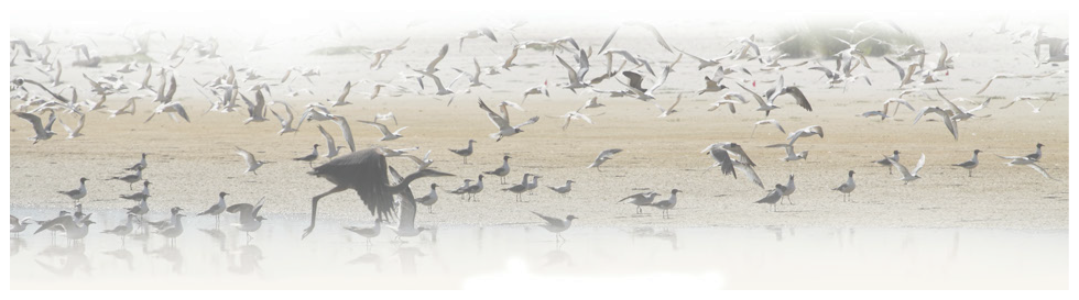
Fallout – Describes the congregation of large numbers and species of migrating birds that arrive at near-shore sites during spring migration in the face of poor meteorological events, such as late arriving cold fronts. In the face of strong north winds, birds seek the first available landfall after crossing the open waters of the Gulf of Mexico.
Website -Mozart Mark Dedeaux
Birding Ethics
Contact Us
Website Feedback
New Trail Nomination
Updated: 9/17/2013